
Water! Water!
Lost streams
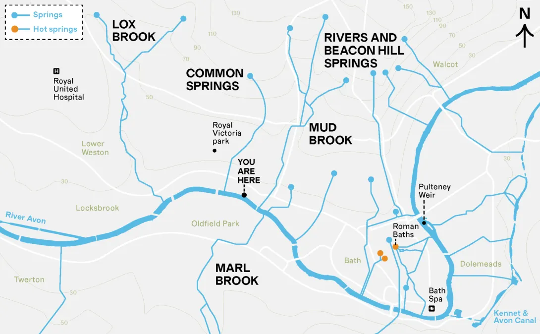
Natural springs, streams, and brooks once flowed freely through Bath, drawing early settlers with a reliable supply of fresh water for drinking. Many ancient springs still flow underground, hidden in pipes, drains and sewers. Notice clues in names like ‘Locksbrook’ (Lox Brook) and ‘Watery Lane’. Today, the practice of ‘daylighting’ sees buried rivers and streams uncovered to restore nature and reduce floods.
Curious? Find your local stream or river. Where does it begin (the source) and end (the mouth), and where is its catchment*?
*A catchment is the land where rainwater flows into a stream or river
Lost streams
. Use the controls to zoom or view attribution.">